
Somaliland Central
What you need to know about Somaliland's Sovereignty

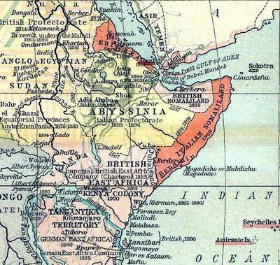
Somaliland which is situated on the eastern Horn of Africa between the 08°00’ and 11°30’ parallel north of the Equator and between 42°30’ and 49°00’ meridian east of the Greenwich. It shares borders with the Republic of Djibouti to the west, Federal Republic of Ethiopia to the south, Gulf of Aden to the north and Somalia to the east. Somaliland has a coastal line to the north of the country which extends 850 km along the Gulf of Aden. The area of Somaliland is 176,120km² (68,000 sq. miles).
Topography in Somaliland is characterized mainly by the coastal plains which rise sharply to the Golis Range (a chain of mountains or succession of mountainous ridges and upland plateau reaching an altitude of over 2000m) running east-west wards. Starting from El-madow in the east towards the Ethiopian highland of Harar and partly tapering to Dhay Mountains of Afar region in the Republic of Djibouti and southern plateau sloping southeast from the highland. The range of mountains acts as the main watershed, draining towards northern coast into the Red Sea and alluvial plains further south, providing some of the most favoured grazing for livestock. Productivity in terms of edible forage for livestock has been greatly reduced by excessive grazing over the years; the reduction in the grass cover is very notable when comparisons are made between today’s cover and that described by early travelers (Swayne in 1895, Drake-Brockman in 1912 and other officers in the colonial period).


Climate
The general climate of Somaliland is hyper-arid, arid and semi-arid. Records collected for over 40 years (before 1974) for Hargeisa (the capital of Somaliland) indicate that there is the probability of rains during five months of the year but the actual amounts vary considerably. The rainy season has two peaks. The first occurs during April to June and is the more important of the two rainy seasons. This is locally known as the “Gu” and is of significant importance to the nomads and the agricultural communities. This rain is brought up by the south-west monsoon which blows during this period. Temperatures at this time of the year are somewhat above the yearly average of 21.7C0 with the highest temperature – around 40oC – occurring in the last half of June.
This rainy season is followed by a short period with less rainfall but with, more significantly, dry strong winds. These winds reach their highest velocities in July. And they have a very serious desiccating effect on vegetation and the annual crops in the agricultural areas. They are most uncomfortable for the human population as well.
A shorter rainy season, locally known as the “Karan” normally begins in August and is confined mainly to areas to the west of Hargeisa. The highest mean rainfall at Hargeisa could be expected during August. This second rain is most significant, not only for the recovery of crops that had been damaged by the strong and dry summer (Haggaa) winds, but also for the short time crops such as maize and dwarf sorghum. This period sees the cessation of the strong winds of the preceding period. During winter both the mean monthly temperature and rainfall drop, though this is associated with tremendous variations as mentioned earlier.
Soils
The soils of the country are generally immature and as a result residual soils are not common. This is due to the very active processes of soil movement by wind and water. The only areas where mature soils exist are in the Juniper forests of the Golis Range, which are confined to the very restricted area of the relict forests. These soils in the Juniper areas are acidic as in the case of the tropical areas. The processes of soil erosion and the subsequent deposition of transported material in the lower valley basins are very remarkably observable patterns. The soils to the south of Hargeisa are largely a product of this type of erosion, and are of limestone origin. The erosion processes carrying away soil from slopes and depositing it in the lower basins result in badly eroded slopes, leaving behind bare areas, devoid of vegetation cover, except where plants grow in the cracks or on soils protected under thorny cover. Further south of this area lies the red sandy soil of the “Haud” and the Nugaal.
Vegetation Zones (Forests, Woodlands and Rangelands)
- a) Coastal and Sub-coastal: – This zone has excellent grass plains with scattered sand dunes and vegetation arcs here and there. The vegetation composes of Suaeda fruticosa (‘xudhuun’), Halopyrum and Salsola foetida in saline areas. The coastal zone itself includes Balanites aegyptiaca in the tree layer and grasses such as lasiurus hirsutus (‘Darif’), Panicum turgidum (‘Dungaare’), Eleusine, Eragrostis and Tragus. The pressure on this zone has increased when Haud, Nugaal grassland plains in the south has deteriorated and traditional routes of grazing has drastically been hampered by the parceling of communal land for private purposes (enclosures)
- b) Highland wood evergreen shrub: This zone covers from 4000ft – 7000ft. This zone is dominated by evergreen plants with usually the relict Juniperus procera (“Dayib”). Little remains of its kind in a strip of land along the ridge and inaccessible places of the range of Golis mountains. In view of serious erosion, overgrazing and cutting has reduced the vegetation cover and replaced with undesirable Dodonaea viscosa (‘Heyramat’), Buxus hildebrandtii (“Dhosoq”), Acacia etbaica (‘Sogsog’), Aloe, Euphorbia and Cadia. Also present are Sideroxylon buxifolium, Pistacia lentiscus and Dracaena ombet and common grasses such as Cynodon dactylon (‘doomaar’),i, Eragrostis spp., Pennisetum villosum, Themeda triandra (‘daba shabeel’) and Eleusine africana (‘garagaro’). The main grass species in this zone is also dwindling. Gullies have spread and reaching the top. It is not uncommon to see the exposed root system of some of the species e.g. Acokanthera schimperi (“Waabey”) as a result of soil erosion The extensive erosion has lead Acacia etbaica to replace evergreen trees and shrubs and the micro-biological species left in the accessible cavities and niches within the top of the escarpments.
d) Gypsiferous Areas (Nugaal): – The vegetation in this zone is extremely varied and is controlled more by edaphic factors than by climate. Rainfall does not exceed 500 mm at elevations of above 1,400 m in the vicinity of Erigavo where Acacia etbaica is abundant. Lower down grass cover has been depleted by years of heavy grazing, but indications are that here as well as in the Acacia bussei zone, Chrysopogon was the dominant grass. These areas provide some of the most sought after grazing and consequently are under constant heavy pressure. The gypsiferous areas also extend south of the Xadeed plain into the Nugal valley at an elevation of around 800 m where there is an annual rainfall of 100 mm. In these lower and hotter habitats vegetation is much sparser, although many species are common throughout. Chrysopogon aucheri, Sporobolus ruspolianus (‘Sifaar’), S. ioclados and Dactyloctenium robecchii are the grasses commonly found, but soil conditions and past grazing pressures determine their abundance. Woody species are becoming more common such as Cadaba mirabilis, C. heterotricha (‘Higlo’), Salvadora persica (‘Cadey’) and in the sinking holes characteristic of anhydrite areas of Acacia tortilis and scattered Ficus spp.
e) Haud-Type Mixed Bush: – This type of vegetation lies mainly to the south of the Acacia Bussei beltc) Acacia Bussei Open Woodland: – The mean annual rainfall in this zone is generally between 200-300 mm. The area is usually described as open woodland, but much of the tree component is now dead except in the vegetation arcs where run-off from interspersed bare areas has been retained there by enabling grass and trees to survive. Extensive “bans” (treeless plains) are a feature of this zone and provide some of the most favored grazing for livestock. Productivity in terms of edible and/or palatable forage for livestock has been greatly reduced by excessive grazing over the years; the reduction in the grass cover is very notable when comparisons are made between today’s cover and that described by early travelers (Swayne 1895). For example, Drake-Brockman wrote in 1912 of millions of acres covered by Chrysopogon aucheri. However, this valuable grass has now been largely replaced by species which are less palatable and less productive. According to Hemming (1966) common daremo grass (Chrysopogon aucheri) is remaining under bushes or in vegetation arcs. Many areas are now converted into bare ground due to de-vegetation processes, long period of drought and over-grazing where the strong turbulent dust storms during Haggaa season (May- September) cause the soil to be transported. These areas are represented by wind-scoured or blowout areas where the finer particles of the topsoil have blown away, sometimes leaving residual gravel, rock, or exposed roots on the soil surface. of open woodland. It is characterized by Acacia and Commiphora species and formerly offered some of the best grazing in Somaliland due to the scarcity of permanent water. Now, however, many areas have a proliferation of “berkeds” (cement cisterns tanks for collecting and storing water) and the rangelands have shown a substantial deterioration.
PRODUCTION SYSTEMS
Livestock Production System
There are three types of livestock livelihood systems in the study area, which are pastoralism, agro-pastoralism and urban stall feeding in which the first two are the main ones.
Pastoral System is confined to the coastal plains, mountain valleys and the plateau over most of the country where the principal, if not the only, feed source is the rangeland grazing and browsing. This is the major livestock production system in which the stockholders and their herds are in movement and this movement follows a quite seasonal pattern which is dictated by the cycle of the precipitation. It is not pure nomadism because these people usually have fixed locations to return to a certain time of the year.
Thus, during the dry season stockholders and their livestock stay near permanent water sources. During the rain season, distances are traveled over a wide area to utilize the available grazing and browse while there is water available in the ponds, depressions and earth dams. The route followed and the time spent on is mostly uniform from year to year except where variations occur in the rainfall pattern.
Agro-pastoral System is practiced in crop producing areas of the country where there is medium to high integration of animals with crops and indigenous grass for fodder production. The cropland provides fodder for livestock feeding and according to SOGREAH studies an estimated amount of 130,000 tones of dry matter is annually produced for livestock feeding from 23,650ha of cropped area, while livestock provides the draught power and organic fertilizer to farmlands, as well as milk and meat for household consumption.
The herd composition of this system is mainly cattle and shoats. During the cropping season, only the milking animals and draught oxen is kept in the fields and the rest of the stock is taken to grazing zones and later are returned to the farmland after crop harvest.
Urban Stall Feeding System is less common and it is mostly practiced in urban centers where families keep some goats and cows to provide milk to their children and some make milk sales. There are no significant diary farms yet.
Crop Production
The main agricultural production belt lies in the area between Hargeisa and Borama districts and in parts of Odweyne and small portion of Erigavo district below the watershed. In addition to this, horticulture is becoming a major activity all along seasonal water courses (Toggs) from the Golis range to the sub-coastal areas in small family holdings. Maize, sorghum and pulses are the major rainfed crops in areas where the rainfall is 300-400mm and where spate irrigation is practiced e.g. Haahi in Odweine district. These crops are always subject to unreliable rainfall. Poor management practices on rainfed cropped areas and fallow areas are causing lower soil fertility which in turn leads to decreased productivity and income. Even when harvest is good, most of production is lost through improper storage practices and protection.
Rain fed/Flood Irrigation Crop Production
Rainfed farming is the major production system in which the subsistence farmers cultivate their crops with the moisture obtained from rainwater. It is practiced in the plateau areas of Hargeisa and Awdal regions and Sheikh District, in which the major grown crops are the long term maturing sorghum, maize, and rarely millet, barley and pulses.
The flood irrigation production system is exclusively practiced in some areas in Togdheer e.g. Beer, Odweine, Haahi, Getitaley etc. Rainfall occurring in the Golis Range Mountains to the north of these areas discharges flood water to the said areas through seasonal watercourses (Togga). These waters are harnessed to grow crops. The agro-pastoralists in these areas grow the short term maturing sorghum variety, maize and pulses. They also harvest hay that serves as fodder for export animals.
Irrigated Agriculture
There are two types of irrigation in common use in the study area:
- Gravitational and
- Pumping irrigation
The gravitational irrigation is localized in the mountainous areas where the water source are the springs gushing from mountain bottoms. The water is then conveyed to the fields by the pull of the earth’s gravitational field.
In pumping irrigation, the water sources are the surface aquifers of the seasonal river beds tapped through the construction of shallow wells of an average of 6-20m deep in which centrifugal pumps are used for water extraction using pipes for water conveyance to the fields.


Forestry
During the early 1950s, the first endeavor of forestry programme began in some parts of the country largely in response to concern over the extent of soil erosion that was evident in the area and the subsequent desire to implement conservation work.
This became instrumental to the establishment of the Forestry Department in 1952. The main achievements of Forestry Department were the creation of several forest reserves over an area of approximately 200km2. Six Somali staff had received forestry training in Cyprus, Sudan and Tanzania. Unfortunately, such efforts initiated in the past to manage and protect these reserves have largely failed due to lack of resource commitment to establish and strengthen a functional administrative system. Thus the state of northern forest reserve was largely subjected to serious over-exploitation at the time forestry activities continued at a very low pace through out 1960’s and early 1970’s – largely confined to amenity tree planting for urban and other micro demonstrational reforestation programs using food for work (FFW). The tree lined avenues of the major towns of the country is a clear indication to early work. The country has no significant forest plantations except limited trial sites of Gacan Libaax and Daallo respectively.
Frankincense production was a small lucrative business before the war. Prior to the war the frankincense trade was state-controlled, but both the trade and its regulatory mechanisms were disrupted during the civil war. Somali gum collectors, who are predominantly nomads, are exploited by the existing merchant chain. The merchants buy gums from collectors at throwaway prices during the harvest period when the gum is plentiful. The collectors are at disadvantage, as in most of the cases the harvest time coincides with the dry season when the nomads can earn the least income from their livestock.
Wildlife
The region has been known to be rich in biodiversity with 200 bird and animal species unfound else-where. According to literature going back to the 19th century, most of Somalilands’ area was teeming with wide variety of wildlife. There is mention of elephants and rhinoceros around Mandera between Hargeisa and Berbera (Swayne, 1895). Large mammals with several endemic species were concentrated on diverse habitats of the country. These included lions, elephants, Gazelles, Somali Wild Ass, Dorcatragus Megalotis (‘Beyrac’), Ammodorcus clarkie (‘dib-tag’), Gazella soemmeringi, Oryx (Oryx gazella) and so forth. Traditionally, hunting the wildlife for subsistence and economic gain was an uncommon practice and indeed was regarded as the task of the inferiors.
Predators (lions, leopard, cheetah, hyena etc) were controlled by bonfire, which was a common defense mechanism against them before the acquisition of the gun. Pastoralists burned large patches of forest or woodland in places ridden with predators in order to drive them out. However, long before the civil war, some major mammals such as elephants, giraffe etc disappeared whilst the lion, Oryx, Alcelaphus buselaphus swaynei (‘Siig’) and The Somali Wild Ass populations declined significantly and was no longer present in areas where they used to populate.
Reports indicate that lions were very common in the country. Now they only arrive occasionally from Ethiopia and return due to absence of suitable habitats. For some mammals however, positive trend can be reported. This concerns baboons and warthogs, after the decline of their natural enemies such as the lion and the fact that they are religiously or culturally tabooed. Because of the increase in their number on one hand and the decline of wild fruits and grazing abundance on the other, these animals – baboons in particular – have become aggressive in posing havoc and destruction on farmlands. However, it has been reported that the population, gazelles and gerenuks are slowly recovering in some areas particularly in the coastal and subcoastal zones. A small herd (less than a dozen) of the Somali Wild Ass (Equus asinus somalicus ), alerted by the IUCN as critically endangered, has been sighted in August 2005, in the mountainous area of Badhaadho to the south of the coastal Shalaw village and north of Hol-hol in western Sanag. This presumably is one of the last refuge of this endemic animal. Wild populations have declined for a number of reasons: For one thing, local people hunt them for food and for use in traditional medicine. (Some people believe the animals’ fat is an effective treatment of tuberculosis). Hunting and drought has taken a greater toll in recent years, as political unrest in the area has allowed better access to automatic weapons. Other problems include increase of human populations and the expansion of agriculture. More and more, wild assess are competing with domestic livestock for limited grazing grounds and water sources. And as the wild and domestic animals come into contact, there is more and more interbreeding – another serious threat to the Somali Wild Ass.

Somaliland Location
Somaliland lies between about 8000-110N and 42030-490E and covers an area of approximately 137,600 km2. It shares land borders with Somalia on the east, Ethiopia on the west and south, and Djibouti on the north-west.


The Perfect Surrounding
Republic of Somaliland 850-km coastline along the Gulf of Aden. The human population is estimated at 3.9 million
Somaliland Strategy
Somaliland present-day has always been of interest for strategic and commercial reasons because of its location near the Bab El Mandeb straight at the entrance to the Red Sea.
Republic of Somaliland


The unrecognised but de facto Republic of Somaliland celebrate 61 years of independence from British rule on June 26th 2021 and on the same year will hold a multi parties’ parliament election. On May 18th of next year Somaliland will celebrated a second independence day marking 30 years since the collapse of the unified Somali state and its unilateral declaration of redraw of union and autonomy. What sets Somaliland’s case declaration of independence apart from many other African movements who have agitated for independence is the fact that the territory enjoyed a brief spell of internationally recognised sovereignty in 1960 between the exit of British colonial power from its protectorate and its subsequent union with the ex‐Italian territory of Southern Somalia. Somaliland looks, taste and smells like a state, then it probably is one.
The British Protectorate of Somaliland gained independence on 26 June 1960 and joined together with former Italian Somaliland on 1 July 1960 to form the Republic of Somalia. In 1991, the central government collapsed and Somaliland declared its independence. It has been a self-governing territory since then, though it is not recognised internationally.
Geographical regions
The three principal geographical zones are: a coastal plain, backed by a range of hills and mountains, and an interior plateau (Haud). 1. The narrow coastal plain (Guban) along the Gulf of Aden reaches up to 35 km in width. 2. A range of hills and mountains known variously as Ogo and the Golis Range, runs west-east; it is lower in the west, reaching its highest point of 2408 m at Shimbiris in the east. In places there are steep escarpments and dramatic cliffs hundreds of metres high, notably at Ga’an Libaax and Daallo. 3. To the south of the mountains, a plateau slopes gently southward towards the Ogaden region of Ethiopia with an elevation generally over 1200 m. Hargeisa the capital is situated at 1348 m. The plateau, or the southern part of it is known as the Haud.
Climate
There are four seasons: The main rains (gu) fall in April–June and shorter rains (dair) in September-October. Precipitation ranges from 200-500 mm across much of the country, reaching 800 mm on the highest parts of the Golis range. July and August are the hottest months. The coastal plain is much hotter than the highlands and the plateau.
Vegetation
Detailed descriptions of the vegetation and soils of Somaliland are provided by Hemming (1966, 1998), on which the following brief summary is based.
Coastal zone
There are many sandy areas particularly in the west, containing the perennial grasses Lasiurus scindicus and Panicum turgidum and scattered trees, most commonly Balanites orbicularis, Acacia tortilis and Boscia minimiflora. There are also patches of mangroves, e.g. near Zeila, and halophytic plant communities.
Mountains
Patches of relict juniper Juniperus procera woodland occur at the highest elevations, the trees draped with hanging lichens such as Usnea articulata. Rainfall reaches 800 mm in this zone and the effects of mist and dew are also important. Small patches of juniper woodland occur at Ga’an Libaax and Wagar; the most extensive remnant is at Daallo Forest, north of Ceerigaabo (Erigavo), and this continues east to Cal Madow in Puntland at about 490E. This zone is subject to heavy grazing and there is very little regeneration of juniper. Below the junipers is a zone of evergreen shrubs consisting mainly of Buxus hildebrandtii, Cadia purpurea and Dodonaea viscosa, usually in mixed stands, but monodominant stands of Buxus also occur. On the northern side of the escarpment at Dallo Forest is species-rich mixed forest that in addition to the species above contains Dracaena ombet, Euphorbia abyssinica, Rhus somalensis, Aloe eminens (a tree aloe) and other Aloe spp.
Plateau
South of the main highlands and below the evergreen scrub zone is a band of Acacia etbaica bushland and woodland, occurring mainly on limestone soils. The many flat-topped limestone hills on the plateau with scattered A. etbaica trees form a typical habitat of beira. Below that is a very widespread zone consisting of open woodland, dominated by A. bussei and also containing A. tortilis, and species of Commiphora and Balanites. Open grasslands or ‘bans’ are found within this zone. The largest of these plains are Ban Tuyo (670 km2) and Aroori plains south of Burco (570 km2). Perennial grasses such as Chrysopogon plumulosus, Dactyloctenuim scindicum Sporolobus spp. and other grasses have been heavily grazed by livestock.
Haud mixed bush
This zone covers a small area in the south of Somaliland and extends east into Puntland and south through the Ogaden to north-east Kenya. It is characterised by Acacia-Commiphora woodland and bushland and contains other trees such as Albizzia anitihelmintica, Delonix elata, D. baccal, Terminalia orbicularis and species of Grewia and Boswellia. In Somaliland, much of this zone is underlain by reddish calcareous sands, forming the ‘red sand bush’ preferred by the Dibatag.
Nugaal Valley
The upper part of the valley consists of a gypseous plain in the south-east of Somaliland running east into Puntland. There are sparse trees, mainly Acacia tortilis and Commiphora spp. as well as shrubs such as Cadaba heterotricha.


Economic
Prospects many oil experts believe that Somaliland has good potential for exploration, although they underline that that potential depends strongly on its international recognition. Apart from oil, the prospects for the gem sector also look positive. Somaliland is situated at the top of the ‘Mozambique belt’ from which two-thirds of Africa’s gems are mined and its gem sector already supports 5 000 livelihoods in Somaliland. Although the lack of mining techniques and poor gem-recognition skills have not allowed the sector to develop its full potential, the recent discovery of a several-miles-long reef of high quality emeralds seems to confirm the view that Somaliland has large quantities of precious stones (The Economist 2001).
From another point of view, the discovery of mineral resources (the prospects for gold and coal production should be added to oil, gas and gems) may empower Somaliland’s fragile institutions and build strong peace, justice and strong central government by the discovery of significant oilfields and high quality emeralds.
Remittances originate mainly from migrant labour in the Gulf and from Somalilanders living in the West (Britain, the United States and Canada). The growth of telecommunications and private remittance agencies has greatly facilitated the transfer of money. The value of remittances is estimated at some US$500 million annually around four times the value of livestock exports benefiting about one-third of Somaliland’s population.
Politic Somaliland:
According to Mohammed Egal 2nd President of Republic of Somaliland and father of Somaliland democracy in his own word declared the tragedy of 1988 in Somaliland was apocalyptic in its dimensions and yet the international community has not stirred from its soporific stance of apathy and yet OAU member states are very reluctant to take the first step (NBC 2001). As in principle, African states are against any plans for re-drawing international borders in the continent. According to the OAU, self-determination is to be exercised only once, at the time of decolonisation from European domination. Thus, although it could be argued that the doctrine of the ‘inviolability’ of colonial boundaries does not apply to Somaliland because it is situated within the boundaries of the former British Somaliland Protectorate.
The birth of Somaliland inevitably resulted from a combination of a distinct colonial experience, extreme economic exploitation and human suffering. The international community has a rare opportunity to bring peace and prosperity to the Horn, before the formers warlords of butchery in Mogadishu ruling still the so-call federal Somalia government wipe out the evanescent hopes of independence in Somaliland.
Birth of a Democracy: Homegrown Bicameralism in Somaliland
The Somalilander Republic creating the House of the Elders beside the standard elected House of Representatives. This upper house plays a part close to that of the British House of Lords, allowing the traditional authorities to be involved directly in the country’s affairs.
Political Settlements and State Formation: Somaliland foundation Institutions
- Balance of power: The beel system “The ‘beel sami qaabse’
- Balance of power: The multi-party system
- Balance of power: The business sector
- Taxation: ‘It is an obligation to pay tax and receiving good services is your right.’
- Education
- The concept of informality
- Consensus over majority voting
- Xeer (customary law and mediation practices)
- Inclusivity
- Proportional representation for the clans (beel)
- Each clan having considerable autonomy within, and responsibility for, events occurring within its territory.